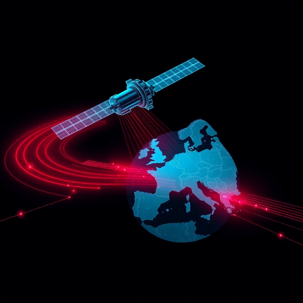
Recent testing has confirmed that Russian satellites possess the capability to jam GPS signals across entire continents, representing a significant escalation in electronic warfare capabilities. This space-based jamming threatens critical infrastructure, aviation, maritime navigation, financial systems, and military operations that depend on GPS timing and positioning. The revelation transforms GPS from a reliable utility into a potentially contested resource, demanding immediate attention from both public and private sectors reliant on satellite navigation.
Introduction
The modern world runs on invisible signals beaming from satellites 20,000 kilometers above Earth. GPS underpins everything from smartphone navigation to power grid synchronization, financial transaction timestamping, and precision agriculture. Now, intelligence assessments and technical testing indicate that Russia has deployed satellite-based jamming capabilities that can deny GPS services across continental areas—a weapon that exists above international borders and beyond traditional defensive countermeasures.
Unlike ground-based jammers with limited range, space-based systems can project interference over massive geographic areas simultaneously. This capability represents a fundamental shift in how electronic warfare can be conducted, turning the orbital environment into a new battlefield where critical civilian and military infrastructure can be disrupted without firing a single kinetic weapon. Understanding this threat is no longer optional for organizations dependent on GPS-derived services.
Background & Context
GPS jamming isn’t new—handheld devices capable of local interference have existed for years. Russia has extensively deployed ground-based jamming systems in conflict zones including Syria, Ukraine, and around its borders. These tactical systems typically affect areas ranging from several kilometers to perhaps 100 kilometers under optimal conditions.
Space-based jamming, however, operates on an entirely different scale. Russian satellites suspected of electronic warfare capabilities include the Olymp-K series and potentially components of the newer Luch relay satellite constellation. These platforms orbit at geostationary altitude (approximately 36,000 kilometers), providing persistent coverage over specific regions.
GPS signals reaching Earth’s surface are remarkably weak—about -160 dBW by the time they arrive. This makes them vulnerable to even modest interference. A satellite positioned in orbit can broadcast jamming signals that arrive at ground receivers with significantly more power than legitimate GPS signals, effectively drowning out the authentic transmissions across its coverage area.
Previous incidents have demonstrated Russia’s willingness to disrupt GPS. In 2018, Norway reported GPS interference during NATO exercises traced to Russian sources. Similar disruptions occurred in the Black Sea region and Eastern Mediterranean. The progression from ground-based to space-based jamming represents a capability leap with strategic implications.
Technical Breakdown
GPS satellites transmit on specific radio frequencies: L1 (1575.42 MHz) and L2 (1227.60 MHz) for civilian and military use respectively. Jamming these signals requires broadcasting noise or deceptive signals on the same frequencies with sufficient power to overwhelm legitimate signals at the receiver.
Space-based jamming offers several technical advantages:
Coverage Area: A single geostationary satellite can theoretically cover approximately 42% of Earth’s surface. Strategic positioning of multiple satellites enables continental-scale coverage with redundancy.
Power Efficiency: Operating from space eliminates atmospheric attenuation on the uplink. The jamming signal travels through vacuum for most of its journey, arriving at ground receivers with higher effective power than ground-based alternatives broadcasting the same wattage.
Persistence: Geostationary platforms maintain constant position relative to ground targets, enabling sustained operations unlike aircraft or ground systems that can be relocated or destroyed.
Attribution Complexity: Identifying the precise source of space-based interference presents technical challenges, providing operational ambiguity.
Testing methodologies to detect such capabilities typically involve:
# Monitor GPS signal-to-noise ratio across geographic areas
gnss-sdr --config_file=monitoring.conf --log_dir=/var/log/gnss/

# Spectrum analysis for interference patterns
rtl_power -f 1575.42M:1575.42M:1k -g 50 -i 1 -e 1h gps_spectrum.csv

# Direction-finding to identify signal source
gqrx --reverse-doppler --satellite-track
Analysts look for characteristic signatures: sustained signal degradation across wide areas, interference patterns consistent with satellite orbital positions, and coordinated timing suggesting deliberate activation rather than equipment malfunction.
Impact & Risk Assessment
The strategic implications of continental-scale GPS jamming are severe across multiple domains:
Critical Infrastructure: Power grids use GPS for precise time synchronization across distribution networks. Loss of timing can trigger protective relays, potentially causing cascading failures. Telecommunications networks rely on GPS timing for cellular tower synchronization—disruption degrades or eliminates service.
Financial Systems: Stock exchanges and banking networks timestamp transactions using GPS-derived time. Jamming could disrupt trading, enable timing attacks on financial protocols, or create record-keeping discrepancies.
Transportation: Aviation depends on GPS for navigation, precision approaches, and collision avoidance systems. Maritime shipping uses GPS for navigation through congested waterways and port approaches. Ground transportation logistics and autonomous vehicle systems similarly depend on position data.
Military Operations: Despite encrypted military GPS (M-code), jamming increases operational friction, forces reliance on backup navigation systems, and complicates precision weapon guidance.
Agriculture: Precision farming uses GPS for automated equipment operation, field mapping, and resource optimization. Disruption during critical planting or harvesting windows causes economic losses.
The risk is amplified because GPS has become a single point of failure for multiple systems simultaneously. A jamming event doesn’t just affect navigation—it cascades through timing-dependent infrastructure in ways that may not be immediately obvious.
Probability of exploitation: HIGH during geopolitical tensions or conflict scenarios. Russia has demonstrated willingness to employ electronic warfare capabilities operationally.
Vendor Response
GPS system operators including the US Space Force’s Space Systems Command acknowledge the jamming threat and have implemented or are developing several countermeasures:
Next-Generation GPS III Satellites: Newer satellites broadcast higher-power signals and incorporate anti-jamming features, though continental-scale space-based jamming still presents challenges.
M-Code Military Signal: Provides encrypted, jam-resistant GPS for military users, though not available to civilian infrastructure.
Signal Monitoring: The US operates a GPS Interference Detection and Mitigation system to identify and locate jamming sources, though attribution and response to space-based sources remains complex.
International bodies including the International Telecommunications Union (ITU) regulate satellite frequencies, but enforcement against military electronic warfare systems proves difficult.
Commercial receiver manufacturers have begun implementing multi-constellation support (GPS, GLONASS, Galileo, BeiDou) to provide resilience through diversity, though sophisticated adversaries can potentially jam multiple systems.
Mitigations & Workarounds
Organizations dependent on GPS should implement layered mitigation strategies:
Multi-GNSS Receivers: Deploy receivers supporting GPS, GLONASS, Galileo, and BeiDou. Jamming all systems simultaneously requires significantly more resources.
# Configure receiver for multi-constellation operation
gpsd -n -N -D 3 /dev/ttyUSB0 -F /var/run/gpsd.sock
# Verify constellation diversity
cgps -s
Timing Infrastructure Hardening: Deploy holdover oscillators that maintain accurate time during GPS outages. Chip-scale atomic clocks (CSAC) provide hours to days of accurate timekeeping:
# Monitor holdover performance
import time
reference_time = ntp_server.get_time()
local_time = csac.get_time()
drift = abs(reference_time - local_time)
if drift > threshold:
    alert_operations_team()
Backup Navigation Systems: Maintain eLoran, inertial navigation systems (INS), or other alternatives for critical operations.
Geographic Diversity: Distribute critical infrastructure across regions to avoid single-point jamming effects.
Monitoring and Alerting: Implement real-time GPS signal quality monitoring to detect jamming and trigger contingency procedures.
Detection & Monitoring
Organizations should deploy monitoring capabilities to detect GPS interference:
Signal Quality Metrics: Monitor carrier-to-noise ratio (C/N0), satellite visibility, and position solution quality:
# GPS health monitoring script
def monitor_gps_health():
    metrics = {
        'satellites_visible': get_satellite_count(),
        'cn0_average': calculate_average_cn0(),
        'pdop': get_position_dilution(),
        'fix_quality': get_fix_type()
    }

    if metrics['cn0_average'] < threshold:
        trigger_alert("Possible GPS interference detected")

    return metrics
Spectrum Analysis: Deploy SDR-based monitoring to identify interference patterns:
# Continuous GPS spectrum monitoring
while true; do
    rtl_power -f 1574M:1577M:1k -g 40 -i 10 -1 scan_$(date +%s).csv
    python3 analyze_interference.py scan_*.csv
    sleep 60
done
Geolocation Correlation: Analyze timing and positioning anomalies across multiple sites to identify wide-area effects consistent with space-based jamming versus local interference.
Best Practices
Conduct Dependency Mapping: Identify all systems relying on GPS for timing or positioning. Many dependencies are non-obvious.
Develop Contingency Procedures: Create documented response plans for GPS unavailability scenarios, including manual operation procedures where applicable.
Regular Testing: Periodically disable GPS inputs to verify backup systems function correctly and staff understand contingency procedures.
Situational Awareness: Monitor threat intelligence sources for indications of potential GPS disruption during geopolitical tensions.
Defense in Depth: Never rely on GPS as a single source of truth. Implement cross-validation with alternative systems.
Rapid Detection: Deploy automated monitoring to minimize time between jamming onset and operational response.
Key Takeaways
- Russian satellites have demonstrated capability to jam GPS across continental scales, transforming electronic warfare reach
- GPS vulnerabilities stem from weak signal strength—jamming requires relatively modest power to overwhelm legitimate signals
- Critical infrastructure across multiple domains faces significant risk from GPS timing and positioning disruption
- Multi-constellation GNSS receivers, backup timing sources, and alternative navigation systems provide essential resilience
- Organizations must inventory GPS dependencies, implement monitoring, and develop tested contingency procedures
- Space-based jamming represents a strategic capability that can affect civilian and military systems simultaneously without physical attack
The era of GPS as an unconditionally reliable utility has ended. Organizations must treat satellite navigation as a contested resource requiring backup systems and operational resilience planning.
References
- US Space Force Space Systems Command GPS Status Reports
- European GNSS Agency Galileo Services Continuity Analysis
- International Telecommunication Union Radio Regulations
- NATO Cooperative Cyber Defence Centre of Excellence: GPS Dependency Studies
- Journal of Navigation: "Detection and Mitigation of GNSS Interference"
- Center for Strategic and International Studies: "Space-Based Electronic Warfare Capabilities"
Stay updated at https://cydhaal.com — Your Daily Dose of Cyber Intelligence.
📧 Subscribe to our newsletter at https://cydhaal.com/newsletter/